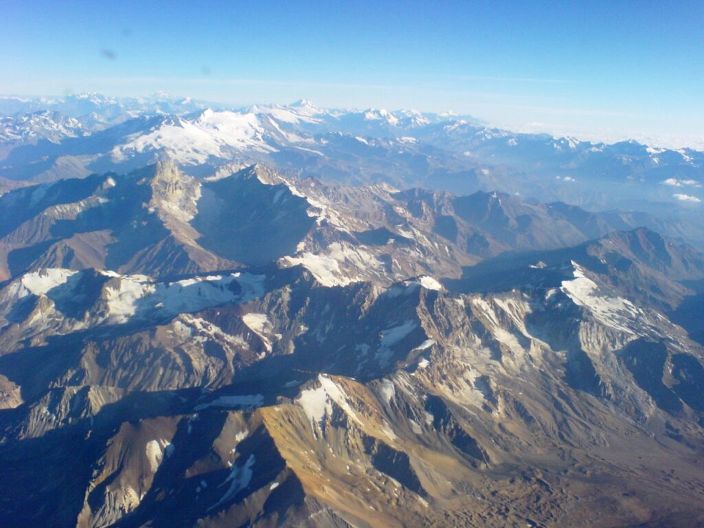
“The Andes Mountains, or Andean Mountain Range (Spanish: Cordillera de los Andes) are the longest continental mountain range in the world, forming a continuous highland along the western edge of South America, extending from north to south through seven South American countries: Venezuela, Colombia, Ecuador, Peru, Bolivia, Chile, and Argentina.” ((Wikipedia). Photo: Jorge Morales Piderit.
By Mariana Meneses
The Central Andes Mountains, in South America, are one of the most tectonically active regions in the world, characterized by high elevations, volcanism, and earthquakes.
The Andes are a result of the subduction of one section of the Earth’s crust, called the Nazca plate, beneath another section called the South American plate, which has caused the uplifting and deformation (i.e. change to the original shape) of the region over millions of years. While the tectonic forces driving the uplifting of the Andes are well understood, the mechanisms responsible for the irregular topography and deformation of the crust have remained elusive until recently.
Subduction is a geological process where one tectonic plate moves underneath another plate and sinks into the Earth’s mantle. The mantle is the layer between the crust and the upper part of the Earth’s core, comprising approximately two-thirds of the mass of the Earth.
In 2022, geoscientists from the University of Toronto found out that the Earth’s outer layer was sinking in the Central Andes Mountains.
While this process, called “lithospheric dripping”, has been theorized for decades, proving its existence in nature has been a challenge. The research sheds new light on the phenomenon, confirming that some regions in the Andes were formed through this process.
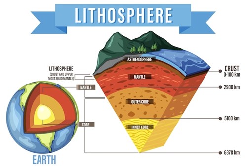
“Earth’s lithosphere, which constitutes the hard and rigid outer vertical layer of the Earth, includes the crust and the uppermost mantle.” Image: brgfx, at Freepic.
The 2022 study, published in Communications Earth & Environment, a journal by Nature, was conducted by PhD candidate Julia Andersen, from the Department of Earth Sciences of the University of Toronto, and co-authors. The focus of the study was the Altiplano-Puna Plateau, characterized by an average elevation of 4,000 meters and significant crustal deformation.
The Earth’s surface is not fixed, but can move and change shape when there is a lot of pressure inside it. Sometimes, this pressure is released in a sudden and violent way, causing an earthquake. Other times, the pressure builds up slowly and makes the surface bend or break over time. This is called crustal deformation.
They looked at old elevation data and found clues of a process called “lithospheric foundering”. To get a deeper understanding of the phenomenon, they built experimental models using special materials and techniques to simulate what might have happened in the past. Their models showed that lithospheric dripping, caused by the sinking of the lithosphere into the mantle, was responsible for the plateau’s great rise and crustal deformation.
While “foundering” and “dripping” are related to the instability and sinking of material from the lithosphere, they are distinct processes that occur at different depths and involve different mechanisms. Foundering involves the detachment and sinking of the entire lithosphere, while dripping involves the detachment and sinking of a portion of the lithosphere.
The team simulated the geological processes and tectonic forces that have shaped the Altiplano-Puna Plateau over millions of years. They used a viscous fluid to represent the mantle and a weak silicone putty to represent the lithosphere. By applying pressure to the silicone putty, they were able to simulate the tectonic forces responsible for the deformation of the lithosphere.
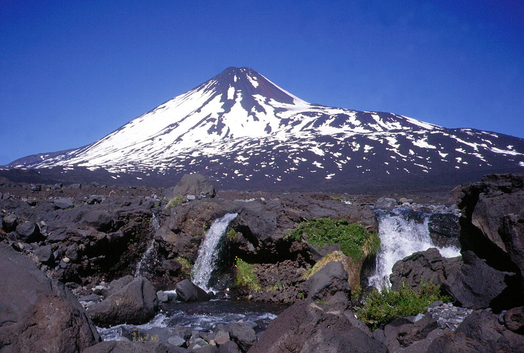
“The Andes host more volcanoes that have been active during the Holocene (past 10,000 years) than any other volcanic region in the world” (U.S. Geological Survey). Photo of Antuco Volcano, Chile: Mono Andes.
The models showed that lithospheric dripping occurred when the lithosphere became too heavy to be supported by the underlying mantle, causing it to sink.
This process led to the formation of a large basin in the model, similar to the one observed in the Altiplano-Puna Plateau.
A basin is a geological structure that is formed by sinking of the Earth’s crust, creating a depression in the land. Lithospheric dripping events involve the detachment and sinking of a portion of the mantle lithosphere, which can create a circular sedimentary basin in the crust.
“Owing to its high density, it dripped like cold syrup or honey deeper into the planetary interior and is likely responsible for two major tectonic events in the Central Andes – shifting the surface topography of the region by hundreds of kilometers and both crunching and stretching the surface crust itself. (…) Overall, the results help define a new class of plate tectonics,” said Julia Andersen.
This sinking of the Earth’s lithosphere into the more fluid layer of the planet’s mantle has caused significant deformations at the surface, and it is more common than one might think. Although lithospheric dripping is a new concept in the field of plate tectonics, several examples of it have been identified around the world, such as the Central Anatolian Plateau in Turkey, and the Great Basin in the U.S.
The study provides a framework for understanding the formation of other high-elevation plateaus around the world, such as the Tibetan Plateau and the Ethiopian Plateau. Moreover, the implications of the study also extend beyond the Earth.
Mars and Venus, two terrestrial planets in our solar system, do not have Earth-like plate tectonics.
However, there are variations in the thickness of their lithospheres similar to those found on Earth. The research on lithospheric dripping in the Central Andes Mountains may provide insights into the geological processes responsible for the formation of high-elevation regions on these planets. Mars features the highest elevation in our Solar system, the volcano called Olympus Mons.
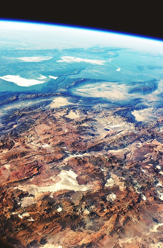
The Altiplano–Puna volcanic complex (lower part of the image). “This image was taken by an astronaut looking south-east across the South American continent when the International Space Station (ISS) was almost directly over the Atacama Desert near Chile’s Pacific coast. The high plains (3000–5000 meters) of the Andes Mountains, also known as the Puna, appear in the foreground, with a line of young volcanoes facing the much lower Atacama Desert (1000–2000 m elevation).” Photo: NASA Earth Observatory.
The discovery of lithospheric dripping in the Central Andes Mountains has shed new light on the geological processes responsible for the formation of high-elevation regions on Earth.
The study highlights the importance of interdisciplinary research, combining geological and geophysical observations with laboratory experimental models, in advancing our understanding of plate tectonics and mountain building processes. The findings may lead to new discoveries in the study of other terrestrial planets, beginning with Earth’s neighbors Mars and Venus.
Understanding the formation and evolution of high-elevation regions on other planets may provide insights into their habitability and geological history and could ultimately help in the search for extraterrestrial life.
Interested in exploring related topics? Check out related The Quantum Record articles, such as:
- James Webb Space Telescope Advances Search for Signatures of Life
- The Search for Life In the Solar System’s Ocean Worlds
- Ancient Technologies
- The Cool Neighbors of Our Sun: Citizen Scientists Search for Brown Dwarfs